
Bermeja - That time the US government (allegedly) blew up an island
Originally published September 14th, 2023 on Cohost (RIP)
Bermeja Island was a small, completely unremarkable island off the coast of Mexico's Yucatan peninsula. An uninhabited spec, north of Scorpion Reef, with only one small wrinkle- it doesn't exist.
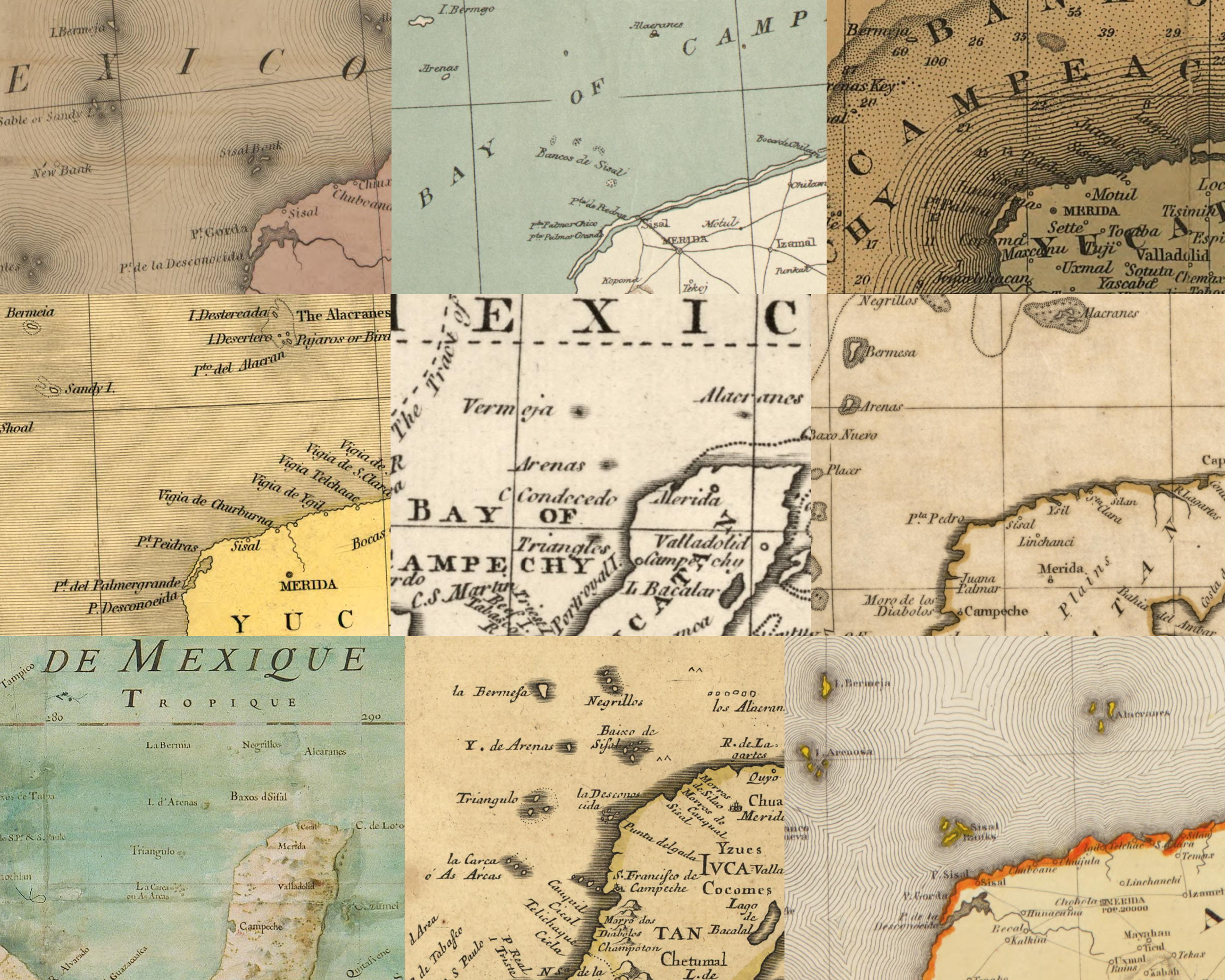
Bermeja (or Bermejo, or Vermeja, or Bermesa, or Bermia- look, we hadn't quite standardized spelling, at this point), had been marked on maps as early as 1539. Named for it's reddish-blond color, the small island was marked and mapped fairly consistently, save for the exact spelling, for centuries.
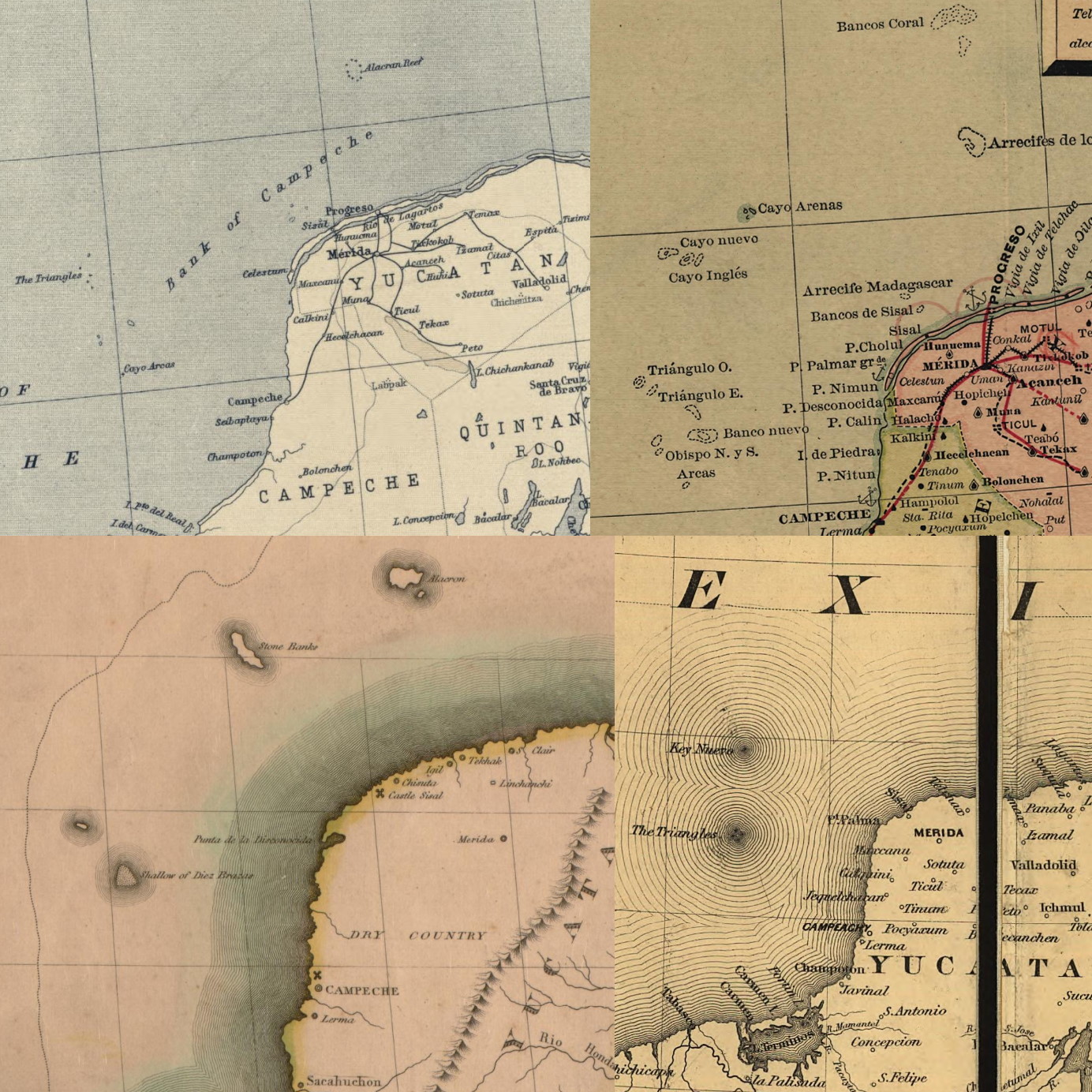
However, doubt had crept in by the late 1700s- expeditions in 1775 and 1789 failed to locate it at it's claimed co-ordinates, and by 1844 a British report said it had sunk 60 fathoms (360ft, ~110m) into the gulf. A French report claimed similarly in 1902, and by 1921 it appeared on it's final map, years after it had been otherwise widely scrubbed.
But this isn't that much to write home about, right? Cartography was as much an art as it was a science before aerial photography and other modern technology, and mistakes happened all the time. There are some other references to it yes, in inventories and other scattered documents, local and official, but the truth is simple and easily observable- if you take a boat out to Bermeja's supposed coordinates, it's just not there. Not only that but there is nothing there. No sunken island, no craggy remnants, nothing, that stands out from the surrounding seafloor.
So Bermeja was largely considered to be a simple cartographic mistake, copied and relayed by new cartographers building off the works of the old. And heck, a British map cleanup from the late 1800s removed some 120 false islands from their official maps, sometimes places simply do not exist. So, case closed, right? A simple case of cartographic error, copied by artistic telephone over centuries, never checked because no one really went there.
That was until the 1990s, and one simple three letter substance- OIL. In the late 90s, the US government and Mexico were trying to draw precise lines about who owned what in the Gulf, and that required finding the farthest out pieces of land each country owned. Maritime borders are drawn up to 200 nautical miles out from a country's coastline, and, if real, Bermeja would be the northernmost point, giving Mexico extra land in the oil rich gulf. But, alas, a new expedition in 1997 only confirmed what we already knew-
But it just didn't sit right with some people. How can an island "exist" for centuries, and then suddenly not be there? Conspiracy must be afoot, decided six senators from Mexico's conservative National Action Party, and so they put forth quite a theory: the US Government blew it up.
Yes, according to these officials, US Government interests had blown up Bermeja, wiping it from the map in order to reduce Mexico's claim in the Gulf. How the US Government, who certainly is no stranger to meddling in the Global South but also can't do it without a paper trail six miles wide managed this is never elaborated upon.
That's the story of Bermeja Island- the small Mexican island that (probably) didn't exist, and (probably) wasn't blown up by the US Government.